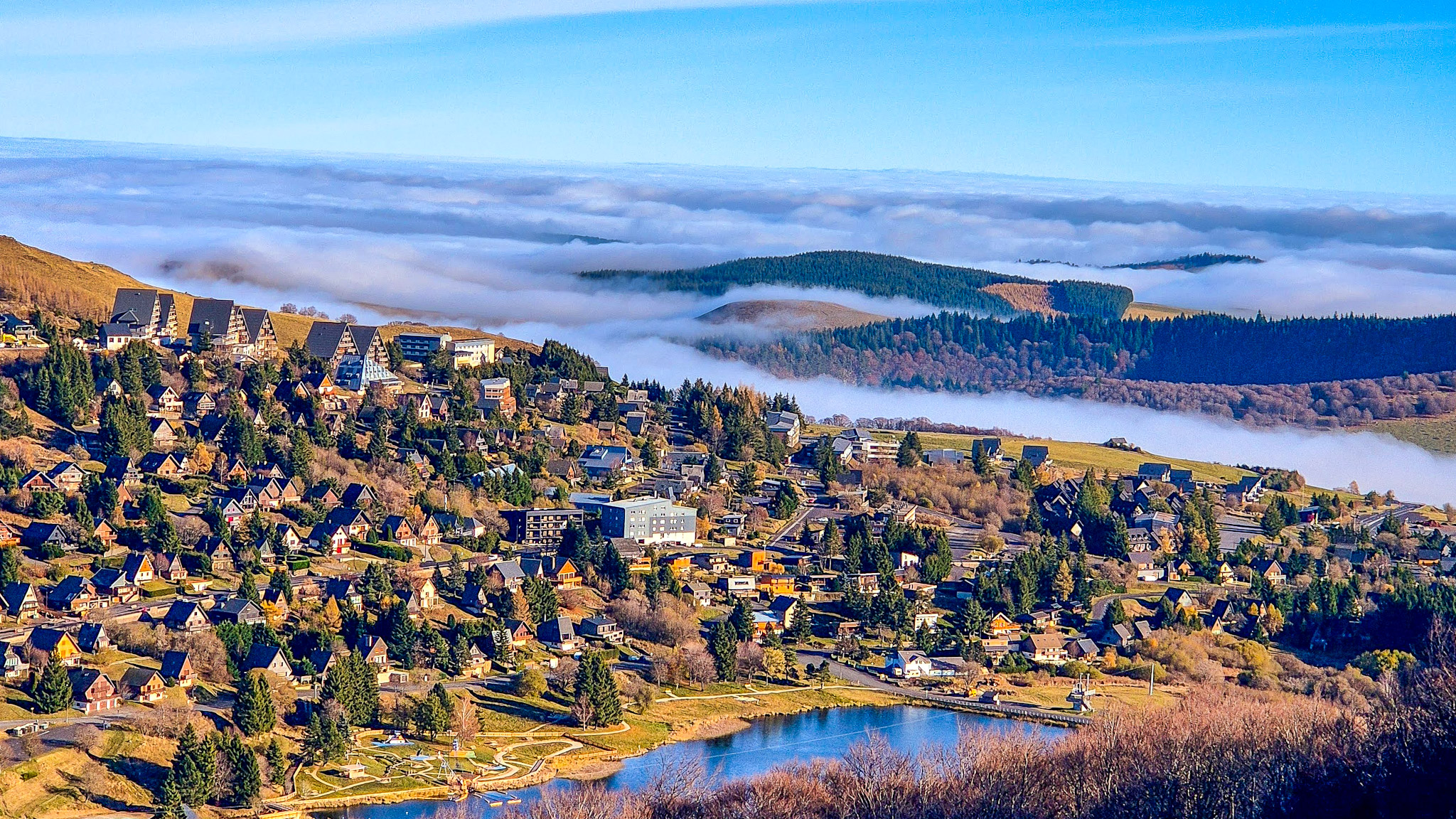
Mer de Nuages, also known as "sea of clouds" or "ocean of clouds", are fascinating weather phenomena that occur when clouds of moisture accumulate below the summit of a mountain or plateau, creating a spectacular visual effect that resembles a sea of clouds. Super Besse, a ski resort located in the Auvergne mountains, is renowned for offering incredible views of Mer de Nuages, attracting many visitors and nature enthusiasts. In this essay, we will explore the reasons why this phenomenon occurs, the best time to observe it in Super Besse, how a Mer de Nuages forms and how to predict its occurrence.
Explanation of the phenomenon
The Sea of Clouds form when moist air is pushed by prevailing winds up the slope of a mountain. As the air cools as it rises, the temperature drops below the dew point, causing water vapor to condense into tiny droplets that form clouds. These clouds can then accumulate and stabilize below the mountaintop, creating the illusion of a sea of clouds extending as far as the eye can see.
Best time to observe the Sea of Clouds in Super Besse
The best time to observe the Sea of Clouds in Super Besse is generally during the spring and fall months. During these seasons, weather conditions are often more stable and the temperature variations between the air at high and low altitudes favor the formation of clouds. Additionally, mornings and evenings are often prime times to observe Seas of Clouds, as this is when the air is generally cooler and more conducive to condensation.
Formation of a Sea of Clouds
As mentioned earlier, a Sea of Clouds forms when moist air is pushed upward by topographical factors, such as mountains or plateaus. As this air cools as it rises, it reaches the dew point and condenses into clouds. If atmospheric conditions are favorable, these clouds can persist and accumulate below the mountaintop, creating a Sea of Clouds.
Predicting a Sea of Clouds
It is often difficult to accurately predict the occurrence of a Sea of Clouds, as it depends on many meteorological factors, such as air humidity, temperature, and wind movements. However, there are some indications that can help predict the formation of a Sea of Clouds. For example, if the sky is clear in the morning with a rapid rise in temperature, followed by a gradual cooling later in the day, it is possible that conditions are conducive to the formation of a Sea of Clouds. Additionally, observing the direction of the clouds and prevailing winds can also provide
Decouvrir nos réseaux sociaux : Super Besse - Sea of Clouds over the Super Besse Station


